How DroneTrack finds every drone, and the pilot flying it
DroneTrack listens for the radio links every drone needs to fly, works out which way they come from, and shows your team the drone and its pilot on one screen. No internet and no installer needed.
The radio range the receiver scans, in every direction
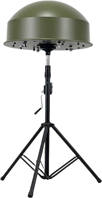
6 antennas
A circular array that turns a signal into a live bearing
360°
Coverage around each unit, up to 40 km for consumer drones and 80 km for military drones
Under 1 min
From power-on to detecting, with no calibration flights
It hears the drone, even when Remote ID is off
Every drone needs radio to fly. The pilot's controller sends commands, and the drone sends back telemetry and usually a live video feed. DroneTrack's dual-channel software-defined radio scans 70 MHz to 6 GHz around the unit for those links, so it finds drones that never broadcast Remote ID.
What the unit listens for
Command and control. The link from the pilot's controller to the drone, which also leads you to the pilot.
Telemetry. The status and position data the drone sends back to the pilot.
Video. The live camera feed most drones stream to the pilot.
Cellular. Drones flown over 3G, 4G and 5G networks.
Remote ID. The ID and position many drones broadcast over Wi‑Fi (2.4 and 5 GHz) and Bluetooth LE, read by two dedicated receivers that work alongside the direction finder. [REMOTE ID STANDARDS]
It tells a drone from Wi‑Fi and background noise
On-device AI checks each signal, separates drones from Wi‑Fi and background noise, and names the drone type. It runs on the unit, so detection works with no internet connection. [DRONE LIBRARY] [FALSE ALARMS]
A direction first, then a position
One unit tells your team which way to look. Two or more show where the drone is, and where its pilot is standing.
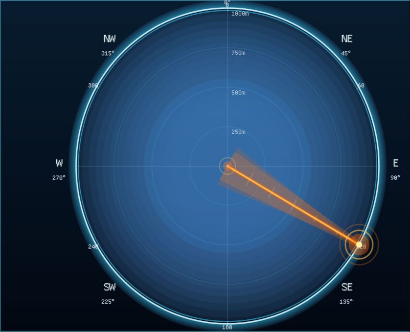
Real capture from the DroneTrack software: the live bearing to a detected drone.
One unit: a live bearing
Six antennas sit in a circle around the unit. A fast switch samples the signal at each antenna in turn, and the unit compares the readings to work out the angle the signal arrives from. The software shows that angle on a compass and keeps it updated as the drone moves. Bearing accuracy: [BEARING ACCURACY]
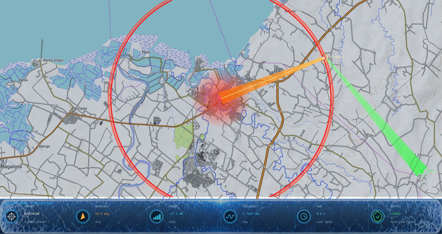
Real capture: bearings from two units crossing at the estimated target.
Two or more units: the drone and the pilot
Each unit draws its bearing on the map. Where the bearings cross, the software marks the drone's estimated position, live. The same works for the pilot's controller, so your team knows where to go. A GNSS receiver in every unit keeps the network aligned. Recommended spacing between units: [UNIT SPACING]
Your team sees it at once, on desktop and mobile
When a drone is confirmed, DroneTrack sends an instant push alert to your team's desktops and phones and logs the incident automatically. Your team sees the drone, its bearing and, with two or more units, its position and the pilot's. [TIME TO ALERT]
Instant push alerts to desktop and mobile
Every incident logged automatically
Several drones tracked at once [MAX SIMULTANEOUS DRONES]
Detection runs with no internet [ALERTS WITHOUT INTERNET]
DroneTrack is a detection system. It detects, identifies and locates drones and their pilots, and alerts your team.
One unit does not give a position
It gives a live bearing. To see where the drone and the pilot are, you need two or more units.
Range depends on your site
Up to 40 km against consumer drones and 80 km against military drones, but terrain, line of sight and where you place the unit all change what you get.
Remote ID details depend on the drone
Only drones that broadcast Remote ID show their ID and operator details, and compatibility depends on the broadcast format and region. Drones without it are still found by their radio links.
Not sure how many units your site needs?
Buy one unit online today, or tell our engineers about your site and get a recommended setup within 1 business day.
Passive RF direction-finding and Remote ID drone detection, engineered and built in Columbus, Georgia 31909, USA. 500+ units deployed in 20+ countries.