Made in USA · In stock, ships worldwide · Plug-n-play in under 1 minute
SOFTWARE PLATFORM

See every drone, its bearing and its pilot on one screen

The DroneTrack software platform comes with every $5,995 unit: live tracking, Remote ID, alerts and incident logs on desktop and mobile, with no licence to buy.
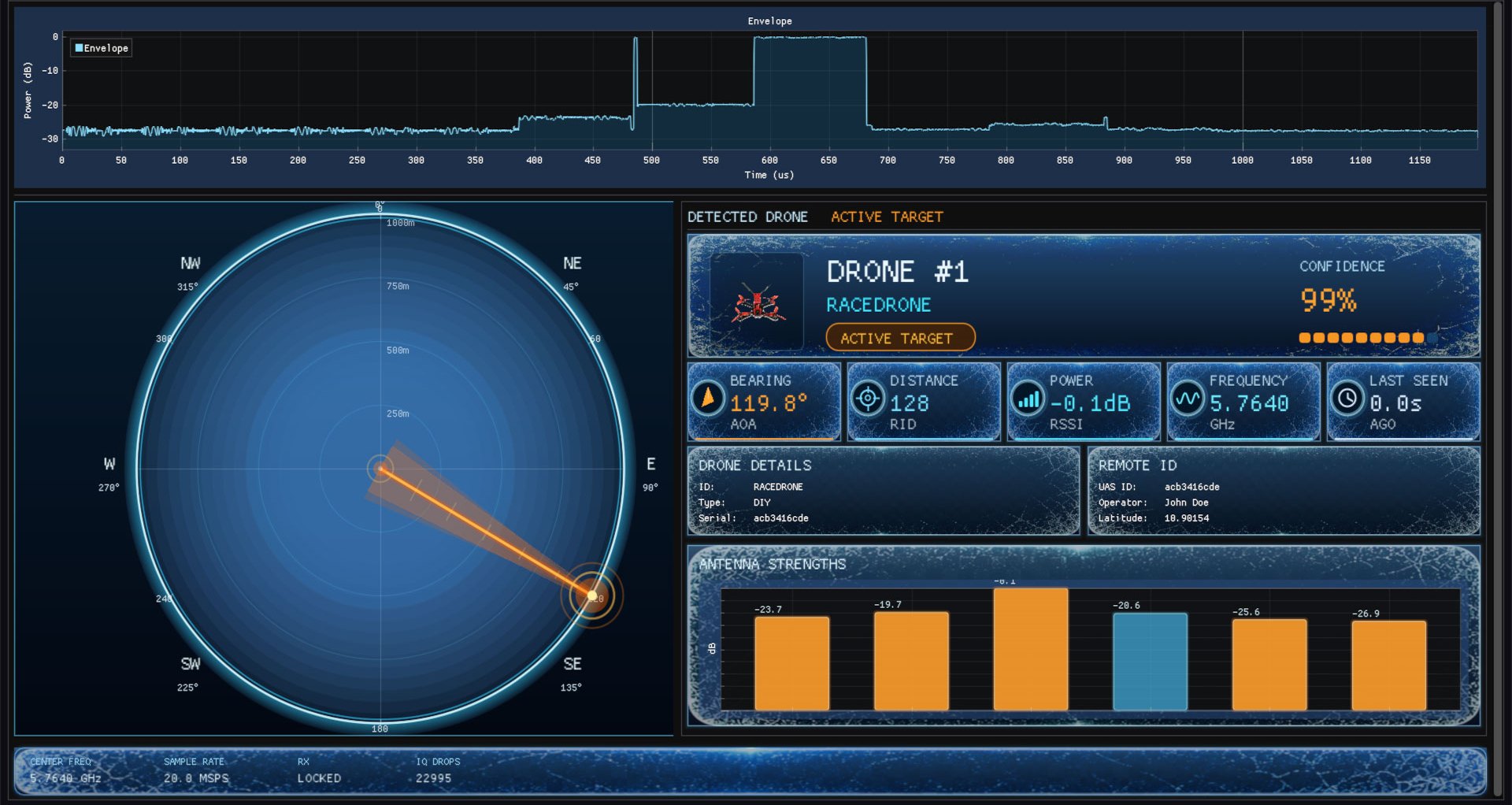
DroneTrack software dashboard showing a detected drone's bearing on a compass, 99% confidence, Remote ID and antenna strengths
  • Included with every $5,995 unit
  • Desktop and mobile apps
  • No licence to renew
  • Detects with no internet

What your team sees the moment a drone powers on

Every detection fills the same screen. Here is what each part means, using a real capture from the software.
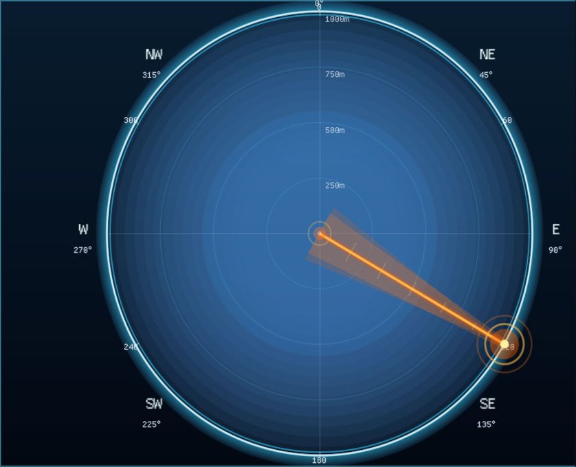
Compass view with a live bearing wedge pointing to a detected drone

A live bearing, not just an alert

The compass shows the direction of the drone from the unit in degrees, and updates continuously. Your team knows which way to look and where to send people, instead of searching the sky.
Detected drone card showing drone type and a 99% confidence score

What it is, and how sure the system is

On-device AI names the drone and its type and shows a confidence score, 99% in this capture. Your team can decide quickly whether to act.
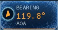
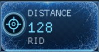
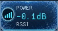
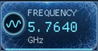
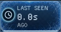
Bearing tile showing the angle of arrival in degreesDistance tile with distance from Remote IDPower tile showing received signal strength in dBFrequency tile showing the drone link frequency in GHzLast seen tile showing seconds since the drone was heard

Bearing, distance, power, frequency and last seen at a glance

Five tiles sum up the target. Distance comes from the drone's Remote ID broadcast. Last seen counts the seconds since the drone was heard, so you know at once when it goes quiet.
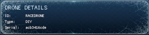
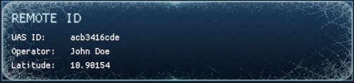
Drone details panel with ID, type and serialRemote ID panel with decoded UAS ID, operator and position

Who is flying it, when the drone broadcasts Remote ID

When a drone sends Remote ID over Wi-Fi or Bluetooth, the software decodes its UAS ID, operator and position and shows them next to the drone's ID, type and serial. Drones that don't broadcast are still found by their control and video links.
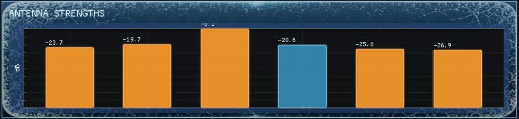
Bar chart of signal strength at each of the six direction-finding antennas

The raw signal behind every bearing

Each of the six direction-finding antennas shows its own signal strength, so your team sees the readings behind the bearing, not just a single number.

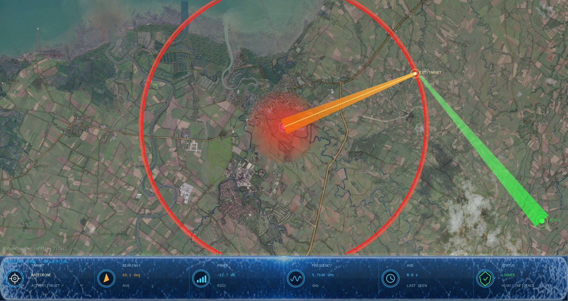
Add a second unit and see where the drone is, not just which way

Each unit draws its bearing on the map. Where the two bearings cross, the software marks the estimated target position, live. Networked units locate the pilot the same way, and the GNSS receiver in every unit keeps them aligned.
  • Street or satellite map, with the detection radius around each unit
  • Target, bearing, power, frequency and age along the bottom of the map
  • Status shows when the target is locked with high confidence
Satellite map view with detection radius and bearings from two units meeting at the drone
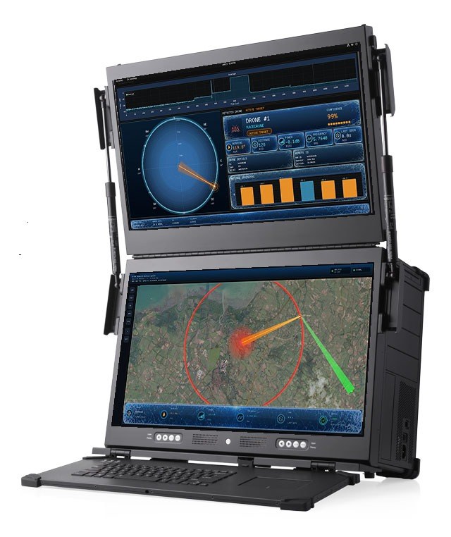
DroneTrack software running on a rugged dual-screen field station
Example setup: the dashboard and map on a rugged dual-screen field station (not included).

Runs where your team works

Desktop

The full dashboard and live map on a desktop or laptop in your control room. [DESKTOP OS]

Mobile

Instant push alerts and the live view on your phone, wherever your team is. [MOBILE PLATFORMS]

In the field

Take the dashboard and map to a temporary site on a rugged portable workstation.

No internet, no licence, no surprises

Is there a licence or subscription?
No. The software and the desktop and mobile apps are included in the $5,995 price, with nothing to renew.
Does it need internet?
Not for detection. The AI runs on the unit, so it detects, identifies and locates drones with no connection. [ALERTS WITHOUT INTERNET]
Do the maps work offline?
The map runs on offline tiles stored with the software. [OFFLINE MAPS]
How many people can use it?
[USERS]
How are alerts sent?
Instant push alerts to desktop and mobile the moment a drone is detected. [ALERT CHANNELS]
Are detections logged?
Yes. Every detection event is recorded automatically and can be exported. [LOG EXPORT] [DATA STORAGE]
Is there a spectrum analyzer?
[SPECTRUM VIEW]
How is the software updated?
[SOFTWARE UPDATES]
Can it connect to our security systems?
[INTEGRATION OPTIONS] Talk to our engineering team: +1 (229) 597-8411 or sales@dronetrack.com.
How is our data protected?
[DATA SECURITY]
Software included. $5,995 per unit, in stock.

Hardware and software made in Columbus, Georgia. Buy online with free worldwide shipping, or talk to sales about multi-unit networks and integration.
DroneTrack home
Passive RF direction-finding and Remote ID drone detection, engineered and built in Columbus, Georgia 31909, USA. 500+ units deployed in 20+ countries.

Threat intelligence briefing

Monthly drone incident data, new signal signatures and regulation updates for security leaders.

Threat Intelligence Briefing

"*" indicates required fields

This field is for validation purposes and should be left unchanged.